
Large tracts of Queensland have been basking in spring-like temperatures this month, accompanied by an unusual weather system.
A high-pressure system and a deep westerly airflow have enabled temperatures to inch to 30 degrees or more in east and southeastern parts of the state over the final weeks of winter.
Brisbane recorded 29.5 degrees, its highest temperature since March, and highest for August since 2018.
READ MORE: PM's call to 'cherish' multiculturalism as Gaza refugee fight drags on
The mercury also soared in other cities: It reached 28.4 degrees in Mackay, the warmest temperature since April, and the hottest for August since 2018; Coolangatta climbed to 28.4 degrees, its highest since April 2024, and highest for August since 2009.
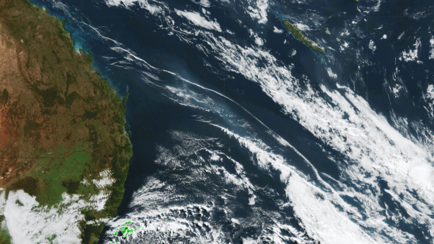
Adding to the unusual conditions was a long atmospheric gravity wave, revealed by a cloud formation spanning about 2500km from the Whitsundays to far northwest New Zealand.
Images from the Himawari-9 satellite showed it spreading east yesterday in two cloudbands.
Just like the ripples that form when a stone is thrown into a pond, atmospheric gravity waves occur when a disturbance causes waves to form in the sky and travel vertically.
In the case of this one, it was likely triggered by severe thunderstorm disturbances in the western cloudband, which formed east of Lord Howe Island, before aligning with a cold front.
Looking ahead, southeast Queensland can expect much milder temperatures from today and some showers tomorrow.
from 9News https://ift.tt/R2iNdmS


