
Tropical Cyclone Narelle has crossed the Australian coast for a second time overnight but forecasters are warning it could hit a third state in coming days.
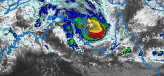
The severe tropical cyclone packed a punch as it made landfall in the Northern Territory, hitting as a category 3 system and bringing with it wind gusts of up to 185km/h.
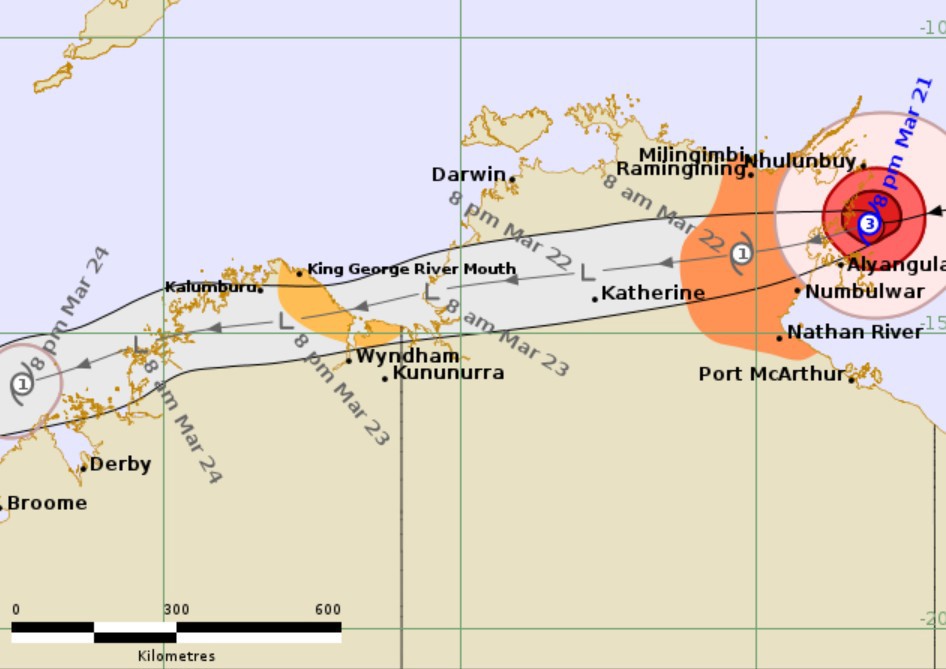
It's now forecast to dissipate to a tropical low as it gets towards Katherine but the Bureau of Meteorology (BoM) has given it a "moderate" chance of becoming a cyclone again on Monday, after moving across the Top End.
READ MORE: 'A real blessing': Clean-up under way after Tropical Cyclone Narelle crosses Cape York Peninsula
"There is a moderate chance that Narelle redevelops into a tropical cyclone while in the Joseph Bonaparte Gulf near the NT/WA border," the latest BoM advice said.
Before heading across to Western Australia, Severe Tropical Cyclone Narelle is set to impact coastal areas between Birany Birany and Numbulwar.
A severe weather warning is in place for heavy, locally intense rainfall with potential for dangerous and life-threatening flash flooding between Birany Birany and Numbulwar, including Groote Eylandt, extending inland towards Bulman on Sunday.
Very damaging wind gusts are also forecast for the region.
As the storm moves west, the bureau warns damaging wind gusts of 90km/h are possible between King George River Mouth and the border region.
Flash flooding caused by heavy rain is possible for the north Kimberley during Monday.
A number of flood warnings are in place across both states.
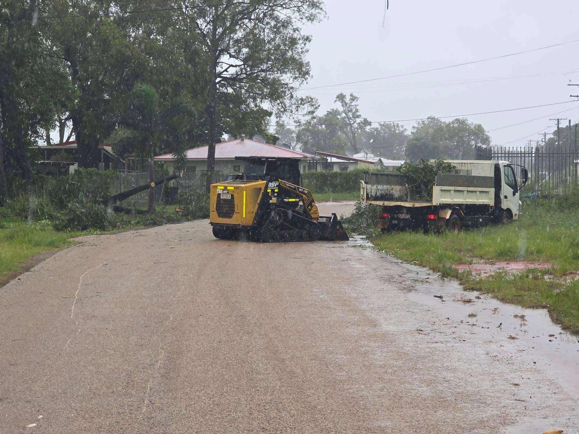
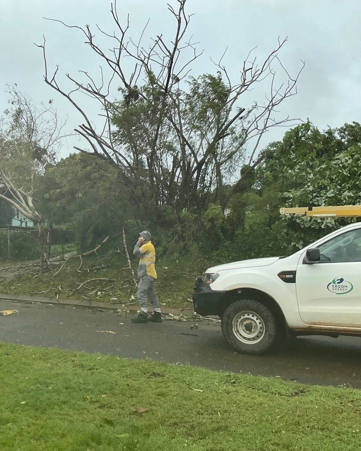
Queensland cleanup under way
Meanwhile, multiple flood warnings remain current in Queensland, which was the first state hit by the storm.
Tropical Cyclone Narelle swept over the Cape York Peninsula, narrowly missing populated communities.
Despite up to 400mm of rain falling in parts of the state, swelling creeks and rivers, Queensland Premier David Crisafulli said the state escaped largely unscathed.
"It walked a tightrope perfectly between Coen and Lockhart River, and then ducked just south of Aurukun as it exited on the western side of the Cape," Crisafulli said.
"The fact that it went right between two of the larger populated centres was a real blessing."
Crews are now working to clear minor structural damage, fallen trees and fix power outages.
Authorities have warned it may take some time to get food and fuel to isolated communities after flood water cut travel by land, leaving the Cooktown airport as the only way to get people and supplies in.
Queensland is now offering assistance to the NT with storm clean-up equipment.
NEVER MISS A STORY: Get your breaking news and exclusive stories first by following us across all platforms.
- Download the 9NEWS App here via Apple and Google Play
- Make 9News your preferred source on Google by ticking this box here
- Sign up to our breaking newsletter here
from 9News https://ift.tt/VZycbNi


